
Tuvalu National Building Code – Coastal Hazard Input
Tuvalu
World Bank | 2024
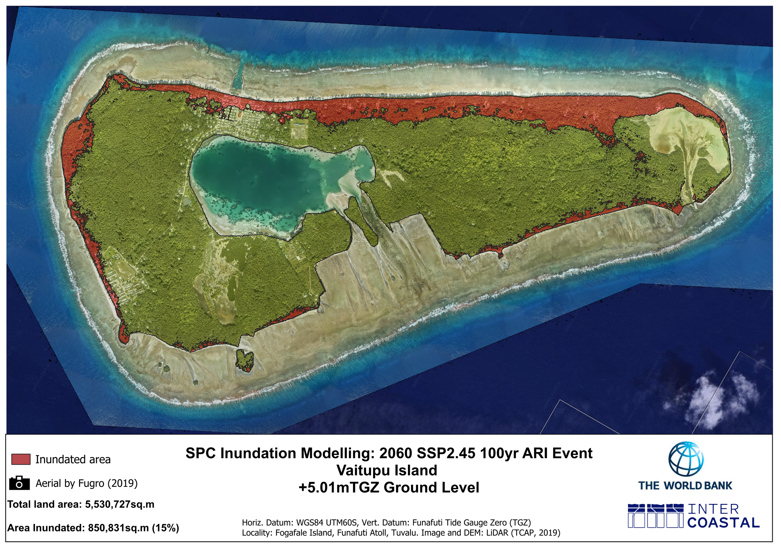
SPC inundation modelling for Vaitupu, showing modelled coastal inundation under a 2060 SSP2-4.5 100-year ARI event.
Integrating Coastal Risk into Tuvalu’s Building Code
As a low-lying island nation, understanding coastal flood exposure is an important consideration in determining appropriate ground and floor levels for buildings across Tuvalu.
Intercoastal provided technical coastal input into the Tuvalu National Building Code to inform built ground levels across the nation.
Using LiDAR and high-resolution numerical coastal modelling outputs from SPC’s climate hazard dashboard, the work supported the development of building floor height recommendations that incorporate coastal flood risk into Tuvalu’s building regulation.
Project Highlights
National application
Technical coastal input supporting Tuvalu’s National Building Code
LiDAR & coastal modelling
Using high-resolution data and numerical modelling outputs
Building floor heights
Recommendations informed by coastal flood exposure
World Bank
Technical input delivered in 2024
Translating Coastal Hazard Information into Building Guidance
Coastal hazard modelling provides detailed information about how different parts of Tuvalu may be exposed to inundation under changing coastal and climate conditions.
For the National Building Code, Intercoastal used LiDAR together with high-resolution numerical coastal modelling outputs from SPC’s climate hazard dashboard to inform recommendations for building floor heights.
This translates technical coastal hazard information into practical guidance that can be applied to future building and development across Tuvalu.
Supporting Coastal Flood Resilience
Incorporating coastal hazard information into building requirements provides a way of considering flood resilience as part of future development.
Rather than addressing coastal risk only through individual protection projects, the National Building Code provides an opportunity to account for coastal conditions when determining appropriate building levels.
Intercoastal’s technical input supported this process by connecting coastal hazard information with recommendations for building floor heights.
Intercoastal’s Role
Intercoastal provided technical coastal input into the Tuvalu National Building Code to inform built ground levels.
The work utilised LiDAR and high-resolution numerical coastal modelling outputs from SPC’s climate hazard dashboard to develop building floor height recommendations based on modelled coastal hazard conditions.
Project Details
Client: World Bank
Location: Tuvalu
Project period: 10 November – 31 December 2024
Services: Coastal Modelling & Investigations · Climate Adaptation & Resilience
